


| Caring for our Coastlines: Beach Science for Everyone |
 |
| Written by Lin Armstrong |
| 09 April 2022 |
|
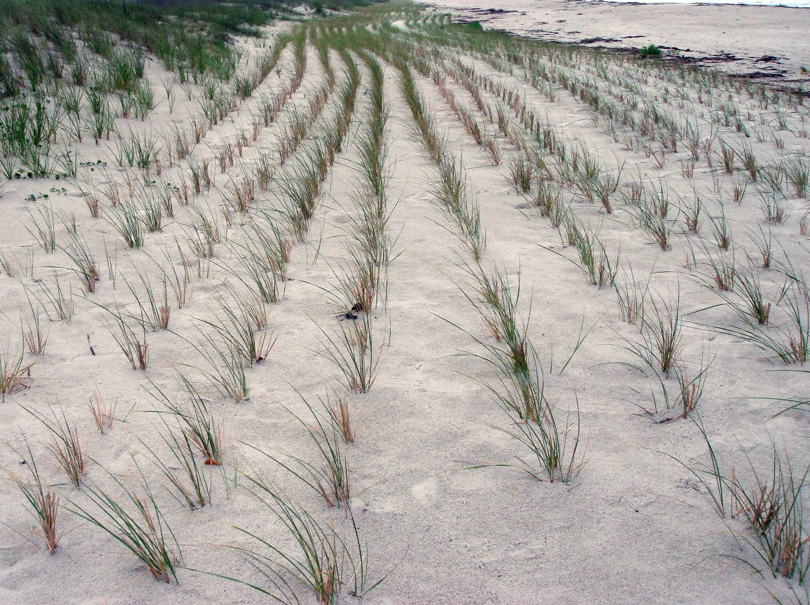
Example of a living shoreline: dune grass planting | Photo Credit: Flickr
Everyone who regularly drives Highway 16 on Haida Gwaii between Daajing Giids Queen Charlotte and Tll.aal Tlell will have noticed that in some areas there has been a dramatic shrinking of the buffer zone, the distance between the shoreline and the road. Where there used to be many trees and bushes and grasses, there may now be only one tree hanging on at a precarious angle. If you thought that maybe climate change has something to do with the erosion of the natural buffer zone, you would not be wrong. Before explaining ways in which locals and visitors alike can help to mitigate or at least help to document these changes, here are some interesting facts about how climate change is already affecting these islands. The water and wave action shapes and constantly reshapes the coastline of Haida Gwaii. Waves reaching the shore carry sediment suspended in the water and push larger sediment along the ground. When the wave recedes, it takes sediment with it. If a wave leaves more sediment, the coastline is extended. If it takes sediment the shoreline recedes. Apparently, the wave climate around Haida Gwaii is the most energetic in Canada and among the highest in North America. The average wave height in Hecate Strait is 1.8 meters with a peak at 10 meters! Another factor in our tides is the shallow Dogfish Banks in Hecate Strait, allowing for the highest tidal amplitude in BC. Since 1950, temperatures on Haida Gwaii have been warming by .5 to 1.1 degrees Celsius, and daily minimum and maximum has risen .9 and 1.1 degrees Celsius respectively. This means that our “frost free” and growing days have increased. However, sea surface temperatures have risen 1.6 degrees C over the course of the 20th century. This is up to four times greater than the global average of .4 to .8 degrees C. Warmer, stormier waters around Haida Gwaii have caused sea levels to rise 1.6 cm each year since 1945. With more storm surges, sea levels could rise up to 30 cm higher by 2050. Scientists who study erosion are reporting that climate change is speeding up the removal of rocks, soil and sand, citing storm surge frequency and rise in sea level as the mitigating factors. These events pose immediate and increasing risks of coastal erosion and flooding. Future Impacts and Possible Solutions It’s not just Haida Gwaii that is facing these changes. All up and down the coast of BC, communities are facing the same scenarios. Think about what will happen to lower-lying areas of the islands with continuous erosion by wind, rain and waves. With a rise in sea levels, there will be more land lost and coastal infrastructure damage (think Highway 16). Areas like marinas and transportation infrastructure will need to plan for the forecasted future. Some parts of the islands are already facing flooding and erosion caused by storm surges and unusually high tides. These include the river crossings on Taaw Tlladwee Tow Hill Road and the Tll.aal Tlell to HlGaagilda Skidegate coastline. To give you an idea of what is happening to parts of Graham Island, contemplate this: over northern East Beach the parabolic dunes are migrating towards the NW and are currently retreating by one to three metres a year. In the past, protecting coastlines often meant “hardening” the shoreline with structures such as sea walls, rip rap, and levees. Although some form of protection is better than doing nothing, there is a growing concern that in some coastal areas, these structures may cause more problems than they solve. They may interfere with natural water currents and prevent sand from shifting along a coastline. They also may cause adjoining beaches and dunes to erode. The newest research shows that utilizing “living shorelines” in some areas, particularly dune areas, has helped to slow erosion without negative impacts. Think natural vegetation to stabilize and protect eroding shorelines. One way to help the dunes would be the use of structural shoreline stabilization techniques, which are nature-based “green infrastructure” protection measures to enhance the natural ability of shorelines to absorb and dissipate storm energy without interfering with the natural coastline processes. It is also imperative that excessive beach activities such as ATV and truck usage of these areas be strictly monitored. Erosion Monitoring and Mitigation in Gwaii Haanas Camille Collinson, Cultural Resource Management Advisor at Gwaii Haanas National Park Reserve, National Marine Conservation Area Reserve and Haida Heritage Sites, says that Park staff have been monitoring areas of erosion for a number of years, particularly where a village site is concerned. Around twenty years ago a geomorphic study by the University of Victoria used a topographic land-to-sea-based laser to set up permanent benchmarks for tracking the erosion. One area of particular concern was identified as the UNESCO village site of SGang Gwaay Anthony Island, where erosion was undercutting the shore and tree root systems. The trees were in danger of falling onto the poles and longhouse remains. The study dismissed “hardening” of the shoreline with rocks as this would just deflect the water to another area. After thorough discussion, it was decided the best way to deal with the threat was to take down the trees and leave the root systems. Again, a geomorphologist report in 2014 suggested rip rap or the creation of a large kelp bed in front of the village site could help slow erosion. Neither happened as again, it would just disperse wave energy somewhere else in the site. Over the past ten years storm events have been throwing driftwood higher than normal, up onto the lower terrace at the village site and in 2018, after another major storm event, over one hundred trees had been blown down. Heavy erosion is also being monitored at the old village site at Louscoone Point, a camping area for visitors across from SGang Gwaay. Park staff at K’uuna Llnaggaay Skedans are using photographs to monitor the changing profile of the beach. Some of the methods Park staff have implemented to help preserve the village sites in Gwaii Haanas include the creation of boardwalks and stair systems, clear delineation of pathways using natural materials such as shells, and the Watchmen at the sites steering visitors away from sensitive areas including middens. Groundskeeping like grass cutting and snipping back vegetation are also ways to mark where visitors can go. Beach grass is not ever included in the trimming as it helps to maintain the dunes. Naay Kun Naikoon Provincial Park Designated a Class A Park in 1973, Naay Kun Naikoon Provincial Park is located on the east side of Graham Island. The park contains a mixture of coastal temperate rainforest ecosystems, wetlands, bogs, sand dunes and beaches. Lucy Stefanyk, Area Supervisor, has been keeping a close eye on erosion in the park, which includes the heavy traffic areas of Taaw Tlldawee Tow Hill, East Beach trail, the Pesuta shipwreck, and the dunes around the Tll.aal Tlell coast. Chris Ashurst, Senior Park Ranger, has been acutely aware of the changes in some areas of the coastline, in particular Agate Beach. Chris has been taking photos in the exact same spot (called Standing Stock Surveys) in different locales, year after year, so he could compare the photos and monitor changes in the beach profile due to erosion. Recently he received a photo taken by Archie Stocker Sr. twenty five years ago of the beach at the base of Taaw Tlldawee Tow Hill. Chris had a more current photo of the same spot and noted that the cabin on the right had to be moved when wave action increased and started throwing logs into the back wall. Both Chris and Lucy record where debris gets washed up on Park beaches. They note the tide line, exact location and what was found. Some shoreline areas are growing. This is called accretion. Did you know that Taaw Tlldawee Tow Hill used to be an island? The constant addition of sand from the east coast has caused it to become attached to Graham Island. The woods on the road used to be lineal beach dunes. Sand is constantly being carried from the east coast, around Nee Kun Rose Spit to Masset. However, there is cause for concern for at least two areas where erosion is very obvious, the mouth of the SGang.an Gandlaay Sangan River and at Gaadas Gandll White Creek. Become a CoastSnap“Coastie” Beach Scientist! CoastSnap (CS) is an innovative community beach monitoring system that is designed to capture and measure changes in coastlines. It is a low-cost technology that turns smart phones into powerful coastal monitoring devices. The project was started in 2017 at the University of New South Wales in Kensington, Australia, with just two stations. Using time series analysis, scientists are able to watch what is happening to beaches and other areas to help them understand how our coasts are changing over time. In 2020, CS partnered with citizen science company Spoteron, and launched a free app to monitor coastline changes. The program quickly spread to many other countries concerned with their own dynamic coastlines. It’s a simple, easy way for scientists to keep an eye on erosion around the world with the help of locals and tourists. Using CS photos, scientists are able to understand how coastlines might change in the coming decades by using a specialized technique known as photogrammetry, which turns photos into valuable coastal data by allowing the position of the coastline to be pinpointed at an accuracy similar to that of a professional coastal survey team.
At the heart of CoastSnap is a simple stainless-steel cradle installed overlooking a beach in a location that is easily accessible by the community and tourists. There is an instructional sign that encourages visitors to place their cellphone into the cradle, take a picture and send it to a centralized database using the free CoastSnap app or on social media using a Quick Response (QR) code and a hashtag unique to each location. The collection of community-led images will provide a record of the coastline as it evolves. The technology behind CS is the ability to create time-lapse videos that track the precise changes in the position of the coastline over time. The Coastie program is a collaboration between Parks Canada and the University of Windsor, Ontario that was recently developed from the CoastSnap community beach monitoring movement. Since learning about Coastie.ca, both Naay Kun Naikoon Park Rangers have signed onto the program. Chris Ashurst has uploaded many of his Standing Stock Survey photos using the app.
Example of a Person Using Coastie Cradle | Photo Credit: Parks Canada
Any municipality, citizens group or organization interested in becoming a part of the Coastie program can contact the University of Windsor Coastal Research Group at This e-mail address is being protected from spambots. You need JavaScript enabled to view it A priority for protecting coastlines is promoting and protecting natural environments using resource stewardship, enhanced coastal flooding and erosion planning, and protection of low-lying exposed coastal, harbour and estuarine areas. Coasties will play an integral part in planning for the future of Canada’s coastlines. If you wish to know the sources used in writing this article, please contact the author at This e-mail address is being protected from spambots. You need JavaScript enabled to view it |